Farmers have an individual need for timely and regular delivery of crop and plot information, but individually the farmers cannot arrange this financially. Businesses focusses on the different aspects of this need and cannot meet this demand individually. By bringing together the demand of individual farmers and letting the market work together – each with their own expertise – it becomes possible to still create an attractive business case for both farmers and suppliers. BIOSCOPE is working on this unique form of collaboration and scaling up in agriculture. By the application of various obtainment methods (satellite in combination with drones or airplanes), the farmer is offered a guaranteed delivery time for his crop and plot information.
BIOSCOPE supplies a complete range of images, soil zone maps, vegetation maps to task maps for the machines, a growing season long. This allows the crop to be scouted in a more targeted way and well-founded decisions can be made. This makes precision agriculture more easy: Apply expensive resources at the right time, in the right quantity and at the right place. It also becomes easier as the production chain is more organized. For example, there is a link with crop registration systems (Dacom/crop-r and Akkerweb) for the maximum possible user comfort, field boundaries are automatically taken over and the information is delivered via the existing management packages.
What is the role of AeroVision within this project?
Aerovision is in charge of the overall project management of this project. AeroVision also brings together different parties and stakeholders and investigates the 'user needs and requirements' and helps to translate these into system requirements. Eventually this resulted in the creation of a business plan and the start-up of the service.
More information & Contact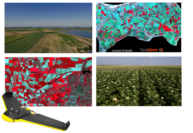
 info@projectbioscope.eu
 www.projectbioscope.eu